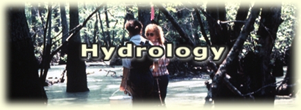

Wetland Hydrology: "The 1987 Manual" refers to wetland hydrology as the sum total of the wetness characteristics in areas that are inundated or have saturated soils for a sufficient duration during the growing season to support hydrophytic vegetation. Wetland hydrology indicators are listed and defined in "The 1987 Manual" and subsequent guidance issued by the Chief of Engineers (Environmental Laboratory 1987, Office of the Chief of Engineers 1992). The two classes of indicators are primary and secondary. Primary indicators are surface features resulting from flooding, ponding, and/or direct observation of groundwater tables. Secondary indicators are characters that result from prolonged subsurface saturation or those that lack strong surface hydrologic features. The indicators observed at Pelham include at least one primary or at least two secondary indicators meeting the criteria for wetland hydrology. Hydrologic indicators at Pelham Range were observed during the growing season of the prevalent vegetation.
Wetland hydrologic conditions are a result of flooding, ponding, and/or soil saturation to the surface for significant periods of time during the growing season. They are typically associated with the floodplains, groundwater discharge areas, and/or nonpermeable surface depressions. The current hydrologic circumstances at Pelham Range are the result of the area's geomorphology, climate, man-induced changes or natural hydrologic modifications that have occurred during the site's development. These changes include road development, building development, training activities, vegetation management, stream channelization, ditch construction, surface impoundments of water, and beaver activity.
Indicators of wetland hydrology found at the 19 sample points include field observations of surface water, soil saturation to the surface, or a recoverable water table within the observation pits. Primary indicators of wetland hydrology at various sample points include inundation, saturation in the upper 12 in., drift lines, sediment deposits, and water marks. Secondary indicators of wetland hydrology at various sample points include oxidized root channels in the upper 12 in. and water-stained leaves. Additionally, all sample points are positive for the Fac- neutral test. Many areas exhibiting hydrology indicators are relative depressional areas on level ground or along stream corridors. These areas appear to collect and retain water for long to very long duration. Generally, depressional areas that are the result of construction activities, roads, or excavations are jurisdictional if they meet wetland criteria under normal circumstances.
Ordinary High-Water Mark: The jurisdictional limits of waters of the United States, excluding wetlands, under Section 404 of the Clean Water Act include lakes, rivers, streams, intermittent streams, ponds, mudflats, and sand flats. These are delimited by the OHW (Federal Register 1986, 33 CFR 328.4c(I).) In the "Federal Register" (1986, 33 CFR 329.11 (a) (I)) the OHW is defined as:
One major perennial stream bisects Pelham Range, Cane Creek. Numerous unnamed perennial and intermittent creeks are tributaries of Cane Creek and account for much of the surface drainage off the property. A few unnamed intermittent streams drain off the property without intercepting Cane Creek. Generally, the perennial and intermittent streams have sufficient volume and velocity of water to create defined channels that are unvegetated and streambeds composed of coarse to fine sediments. Many of the intermittent streams are carrying large sediment loads from upslope erosion that in turn promotes wetland conditions in low slope areas as the sediments accumulate.
Generally, impoundments of waters of the United States, including perennial and intermittent streams, are considered jurisdictional and therefore are regulated under Section 404 of the Clean Water Act. Ponds are scattered throughout the property. Some of the ponds are seasonal and are the result of either recent beaver activity, depressions that impound the surface water, or depressions that expose the groundwater table. Ponds or impoundments that do not exhibit hydrophytic vegetation in normal circumstances are mapped as other waters.