
General: Pelham Range is a mostly rectangular-shaped property of ± 22,500 acres located in Calhoun County, Alabama. The major landforms within the boundary of the property include broad level valleys, gently rolling to moderately steep hills, and a large perennial creek with an irregular floodplain. The major upland plant communities associated with the property are mixed hardwood/pine forest, woodland, open fields, scrub/shrub stands, and riparian zones. Managed areas include roads, buildings, target ranges, and training areas. Three wetland plant community types were found within Pelham Range including forested wetlands, scrub/shrub wetlands, and emergent wetlands.
The mixed hardwood/pine forests are dominated by sweet gum (Liquidambar styraciflua), loblolly pine (Pinus taeda), longleaf pine (Pinus palustris), tulip tree (Liriodendron tulipifera), hickory (Carya sp), oaks (Quercus sp) and red maple (Acer rubrum). In places, the forested areas blend into woodlands with similar canopy species and an understory that includes musclewood (Carpinus caroliniana), cherry (Prunus serotina), dogwood (Cornus foemina), winged elm (Ulmus alata), blackberry (Rubus sp.), honeysuckle (Lonicera japonica), and greenbriar (Smilax sp.). Open field and scrub/shrub plant communities are typically found within the valleys where there has been enough management to interfere with species succession. Species typical of these plant communities include winged elm (Ulmus alata), cherry (Prunus serotina), privet (Ligustrum sinense), dogwood (Cornus foemina), vibernum (Vibernum sp.), sweet gum (Liquidambar styraciflua), panic grass (Panicum sp.), honeysuckle (Lonicera japonica), blackberry (Rubus sp.), and sorrel (Oxalysis sp.). Non-wetland riparian zones along perennial and intermittent stream corridors are characterized by box elder (Acer negundo), cottonwood (Populus deltoides), sycamore (Platanus occidentalis), black willow (Salix nigra), red maple (Acer rubrum), sweet gum (Liquidambar styraciflua), alder (Alnus serrulata), dogwood (Cornus foemina), greenbriar (Smilax sp.), and herbaceous species. Although many of these areas have facultative or wetter plant communities, they do not meet the requirements for wetland hydrology and/or hydric soils.
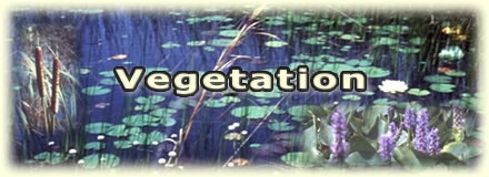
Three types of wetland plant communities are found within Pelham Range. Forested wetlands are scattered throughout the Range and are generally associated with low areas adjacent to streams or within slowly permeable to non-permeable surface depressions. Plant species characteristic of forested wetlands include sweet gum (Liquidambar styraciflua), American elm (Ulmus americana), sycamore (Populus occidentalis), water oak (Quercus nigra), red maple (Acer rubrum), willow oak (Quercus phellos), loblolly pine (Pinnus taeda), and black willow (Salix nigra). Frequently, the forested wetlands contain significant understory communities with a large percentage of facultative or wetter cover in both the scrub/shrub and the herbaceous communities. Scrub/shrub wetlands are scattered throughout the Range and are commonly associated with stream corridors and disturbed areas in valleys. Characteristic species of scrub/shrub wetlands include red maple (Acer rubrum), water oak (Quercus nigra), black willow (Salix nigra), sweet gum (Liquidambar styraciflua), dogwood (Cornus foemina), and many facultative wet and obligatory herbaceous species. Emergent wetlands are scattered throughout the Range and are typically associated with natural and created depressional areas within the valleys or adjacent to streams. Characteristic species of emergent wetlands include soft rush (Juncus effusus), wool grass (Scirpus cyperinus), fireweed (Epilobium sp.), seedbox (Ludwigia alterniflora), witch grass (Panicum virgatum), cattail (Typha latifolia), black willow (Salix nigra), fowl grass (Glyceria striata), seedbox (Ludwigia palustris), goldenrod (Solidago sp.), blackberry (Rubus sp.), sedge (Carex crinita), sedge (Carex vulpinoidea), rush (Juncus marginatus), and water plantain (Alisma subcordatum).
Clarification and Interpretation of the 1987 Manual: The occurrence and type of plant cover determine whether jurisdictional areas are identified as wetlands or other waters. The U.S. Fish and Wildlife Service (Reed 1988) rates plant species based on the prevalence of their occurrence in wetlands. The predominance of hydrophytic vegetation, and subsequent determination of a wetland, is calculated using one of two methods, the 50/20 Rule and the Prevalence Index. The 50/20 Rule (Federal Interagency Committee for Wetland Delineation 1989) is a dominance ratio. When using the 50/20 Rule, greater than 50 percent of the plants must be facultative, facultative wet, or obligate wet species. The Prevalence Index is a weighted average. A site scoring less than 3 on the Prevalence Index meets the wetland hydrophytic vegetation criterion. Both methods are approved for use by "Clarification and Interpretation of the 1987 Manual" (Office of the Chief of Engineers 1992). Those sites with little or no hydrophytic plant cover, not capable of supporting hydrophytic plant communities in normal circumstances, and having an ordinary high-water mark are identified as other waters.
Generally, the occurrence of plant cover determines whether jurisdictional areas are identified as wetlands or other waters. Those sites with little or no hydrophytic plant cover and not capable of supporting hydrophytic plant communities in normal circumstances are identified as other waters, provided they have an ordinary high-water mark. Nineteen sample points were evaluated at Pelham Range. Seventeen sample points rated 100 percent and two sample points rated 85 percent dominant facultative or wetter plant species. No sample point had a prevalence index value greater than 3.