Depressional
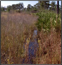 Depression wetlands occur in topographic depressions (i.e., closed elevation contours) that allow the accumulation of surface water. Depression wetlands may have any combination of inlets and outlets or lack them completely. Potential water sources are precipitation, overland flow, streams, or groundwater/interflow from adjacent uplands. The predominant direction of flow is from the higher elevations toward the center of the depression. The predominant hydrodynamics are vertical fluctuations that range from diurnal to seasonal. Depression wetlands may lose water through evapotranspiration, intermittent or perennial outlets, or recharge to groundwater. Prairie potholes, playa lakes, vernal pools, and cypress domes are common examples of depression wetlands.
Example Subclasses

Back to HGM Approach
Web Date: October 1997
Updated: February 2022
|